


Sunrise In Florida, Sunset In New Jersey
An invitation to my sister's wedding in
Jacksonville, Florida affords an
opportunity to exploit the fun, freedom, and luxury in travel by
General Aviation
Page 1 of 3
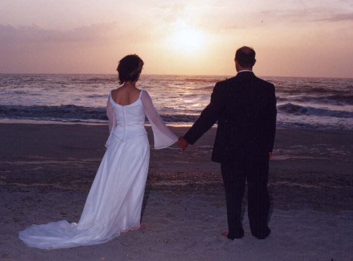
A sunrise wedding in Florida, May 2, 2004
A Pleasant Surprise
My sister called a few months ago to tell me that she and her longtime significant other decided to get married in early May at sunrise on the beach adjacent to their home in sunny Jacksonville Beach, Florida. Naturally, I congratulated her, and let her know that her little brother would be there with bells on. Being a pilot, it took me about 3 milliseconds to figure out that when it came to travel arrangements, I'd rather leverage the Cessna Skyhawk at my disposal than submit to the Transportation Stupidity Agency's rectal exams.
The wedding was scheduled for Sunday, May 2nd, so I figured I'd fly down on Friday, relax and explore a bit with the rental car on Saturday as well as attend a family "meet and greet" dinner later that evening, and then get to bed early in prep for the ceremony. The festivities were scheduled to end early afternoon on Sunday, so I figured I'd either stay in Jacksonville that night and do the entire flight on Monday, or complete the first hop of the return trip and stay there for the night. In any case, I figured that adding a day either side of the ceremony would provide the flexibility to change my itinerary as sometimes required when traveling via small GA. After all, a Skyhawk is a great airplane, but it's not exactly a serious long-distance machine. Its limitations in speed, altitude, and redundant systems are just too numerous to ignore.
 Preparation
We had recently performed a lot of work on the airplane, including fixing a fuel tank leak, so I began preparing for the Florida trip by flying it in conditions that I might expect on the trip, including IMC with moderate frozen and liquid precipitation, and at night.
On one flight from Hagerstown, MD back to home base, I encountered both moderate snow and rain as I skirted the freezing level at 6000 feet over Baltimore. The single static air source in the 172 plugged up a couple times, but short-term use of the alternate static source solved that problem . No biggie, and from what I've gathered, pretty typical of the single-port systems used in 172's.
Probably because I know too much about the mechanicals of this airplane I don't really like flying it at night (what can I say, sometimes ignorance is bliss), so a quick hop to Wilkes-Barre, PA one evening turned out to be my first extended period of night flying with the Garmin 430. During this flight I found the LCD backlighting far too bright in "Auto" mode. During the day, the"Brightness" value obtained via the "Display" page usually varies between 7000-9000, but it only dropped to 4500 at night. I found I had to put the unit in "Manual" mode and reduce the backlighting to 300, and (following about 30 minutes of flight, after which my eyes adjusted) eventually to a mere 250. Incidentally, if you've ever wondered what causes the 430's front panel to get hotter than blazes, it has to do with the backlighting. With the display backlighting at 250, I found the face almost cool to the touch.
Although the avionics appeared to be working normally, I also took the airplane to our avionics shop for a quick check of the communications transceivers using a deviation/power meter, the localizer/glideslope receivers using appropriate test gear, and VOR receivers using a calibrated VOT test source...simply to ensure that I could enjoy the flight, rather than spend my time cursing the equipment and listening to controllers curse me.
 Surprisingly, we found the
#2 glideslope receiver (Narco NAV825) inoperative, but the
localizer and VOR receiver of the unit were found operational,
however. Unfortunately, the timeframe required for the repair
made me a bit uncomfortable, so rather than risk not having a
second navigation receiver, I decided to send the unit out after
I returned. In that case I figured I'd still have ILS capability
via the Garmin 430 and even if I lost that unit, the probability
of encountering low IMC over several states simultaneously was
pretty small. Plus, practically speaking, losing glideslope
capability only raises minimums by 200 feet (to about 400 AGL)
for most localizers, and I figured that if the weather was that
bad, I'd make alternate arrangements.
Surprisingly, we found the
#2 glideslope receiver (Narco NAV825) inoperative, but the
localizer and VOR receiver of the unit were found operational,
however. Unfortunately, the timeframe required for the repair
made me a bit uncomfortable, so rather than risk not having a
second navigation receiver, I decided to send the unit out after
I returned. In that case I figured I'd still have ILS capability
via the Garmin 430 and even if I lost that unit, the probability
of encountering low IMC over several states simultaneously was
pretty small. Plus, practically speaking, losing glideslope
capability only raises minimums by 200 feet (to about 400 AGL)
for most localizers, and I figured that if the weather was that
bad, I'd make alternate arrangements.
Worship The Weather Gods
Most of the week preceding the trip was rainy and messy, which meant that the weekend should be relatively clear. In fact, Thursday turned out to be one of the 10 best days of the year, and one of the warmest this season. After a few last-minute details, including topping the tanks, I went to bed Thursday evening at the ridiculously early hour of 8PM, because I knew full well if I did otherwise, I'd never get up at 4AM, as required to be wheels up at 6:30.
As the departure day dawned, both DUAT and ADDS revealed outstanding whether for the entire route. The only area of concern was from South Carolina south to Florida, where scattered thunderstorms were forecast to develop in the afternoon. While this forecast in itself might be enough to (justifiably) deter small GA from flying in that area, I've found that when I really need to get somewhere, I take weather as it comes.
When it comes to tactical thunderstorm avoidance, in my experience the only thing that really counts is the weather "right now". The airlines are, practically speaking, no more capable of surviving an encounter with a thunderstorm than a small GA plane is, so while their criteria for go/no-go decisions may be a bit different (due to the equipment they have that a small GA airplane does not, like a LARGE waveguide and POWERFUL radar transmitter), the same basic principles apply to both the airlines and small GA. The process of navigating through an area with convective activity is often called "threading the needle", and, done properly, it's about as safe as any other weather situation.
Provided you know how to stay informed, how to read and predict a developing weather situation, and have the sense to know when it's time to land to let things blow over, I think it's pretty amazing at what you can accomplish via small GA. Of course, it doesn't hurt to worship the Weather Gods a bit, by the way. :-)
 With good news in
hand, it took less than 10 minutes of analysis to make the
decision to "Go!". I was wheels up at 6:45AM (15 minutes later
than planned), but the winds were slightly more favorable than
the prior evening's forecast, so I knew I might recapture some of
that delay.
With good news in
hand, it took less than 10 minutes of analysis to make the
decision to "Go!". I was wheels up at 6:45AM (15 minutes later
than planned), but the winds were slightly more favorable than
the prior evening's forecast, so I knew I might recapture some of
that delay.
In-Flight Entertainment
I think music generally enhances the pleasure of flying, particularly during long trips. I've found there's nothing quite like cruising over beautiful terrain on a warm summer day listening to a favorite piece of classical or jazz in full stereo. Talk about "first class" travel!
However, even though I feel very comfortable behind the controls of a 172, I find most forms of entertainment to be sufficiently distracting that I have established a few rules regarding the use of entertainment during flight...no matter what airplane I'm flying.
Rule #1: Music doesn't come on until after I have reached cruise altitude and completed the cruise checklist, and it goes off prior to executing the In-Range checklist (typically 30 miles from the destination, and before the top-of-descent point). This is my version of the "sterile cockpit". Distractions must be kept to a minimum during these critical phases of flight.
Rule #2: Music only comes on if I feel comfortable with the weather situation during cruise. If I'm threading the needle through thunderstorm cells, particularly if there is a chance of being IMC for extended periods of time (thus making circumnavigating storms more challenging) the music stays off while I concentrate on flying the airplane and communicating with ATC and Flight Service to keep apprised of the weather situation.
 The downside
to my portable CD player used up to this point is the need to
switch CDs on a fairly regular basis. It's a pretty simple affair
on the ground, but in an airplane without an autopilot during
mildly turbulent conditions or while IMC, it's a hassle, if not
unsafe. Since I expected to fly about 12 hours round trip with a
relatively few number of legs for extended periods, I figured I'd
upgrade my CD player to a MP3 player and do a review of the
player on the way.
The downside
to my portable CD player used up to this point is the need to
switch CDs on a fairly regular basis. It's a pretty simple affair
on the ground, but in an airplane without an autopilot during
mildly turbulent conditions or while IMC, it's a hassle, if not
unsafe. Since I expected to fly about 12 hours round trip with a
relatively few number of legs for extended periods, I figured I'd
upgrade my CD player to a MP3 player and do a review of the
player on the way.
I long drooled over Apple's Ipod, but its non-field-replaceable Lithium Ion battery and its ridiculous 5 hour battery life, combined with its inability to play music encoded with the phenomenal open-source Ogg Vorbis codec, turned me off.
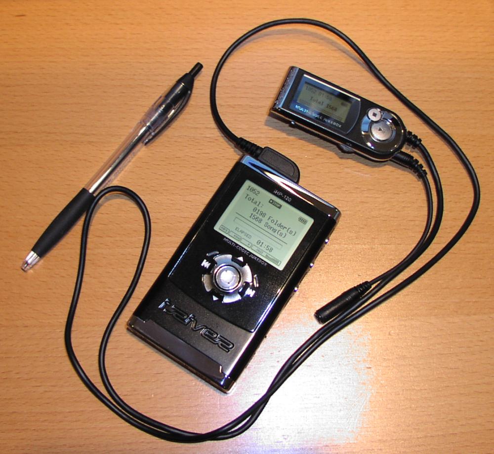
Then I saw the answer to my prayers...the iRiver iHP-120, a 20 gigabyte hard-drive-based player with a tough magnesium case, full-featured and backlit remote control, multi-codec support, FM receiver(!), leather carrying case...and yes, a Lithium Polymer battery with power to run the player for a full 16 hours(!) -- all for a reasonable street price of $360. Try getting a FAA-certified MP3 player for that! The various reviews I read about it confirmed my perceptions that this was one kick-ass player, so I decided to purchase it and ship it to arrive a few days prior to my departure so I could figure out its strengths and weaknesses on the ground. No sense fiddling with it in the air.
To Newport News
I planned my usual coastal fuel stops - Newport News, VA (KPHF), Grand Strand, North Myrtle Beach, SC (KCRE), with my final destination being Jacksonville, Florida's Craig Field (KCRG)...an airport only a few minutes from my sister's house, and (thanks to sis) my hotel as well.
 The
legs from 3N6-PHF and PHF to CRE turned out to be textbook IFR
flights in visual conditions. On the way down to Newport News, I
climbed to cruise at 6000 to find my groundspeed within a few
knots of plan, and got the time to play with my new entertainment
system.
The
legs from 3N6-PHF and PHF to CRE turned out to be textbook IFR
flights in visual conditions. On the way down to Newport News, I
climbed to cruise at 6000 to find my groundspeed within a few
knots of plan, and got the time to play with my new entertainment
system.
I found that the Jazz EQ setting produced the most acceptable tonal balance for mixing music and ATC communications -- the idea being to emphasize the high frequencies because of the relatively low volume, but not overemphasize the low frequencies because they can be a bit distracting. Combined with the ISO setting on the PS Engineering audio panel to prevent muting when the comm desquelched, and a remote that allowed easy navigation of the music library, I was immediately sold on the iHP-120 for aviation use.
After what seemed like half the actual time (no doubt due to the music making time fly) I found myself talking to Norfolk Approach in preparation for approach to Newport News. Norfolk cleared me direct to the field for the visual approach approximately 25 miles north, and before long, I had the airport in sight.
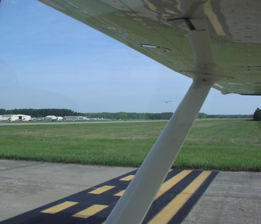
I found a familiar, friendly voice working the tower frequency. He really seemed to enjoy working with us "small fries". As he was working several other aircraft in the pattern for runway 20, he issued me a Land and Hold Short (LAHSO) clearance for runway 25, which I accepted and executed. In the picture, I'm on a taxiway between runway 25 and 20, waiting until the ground controller cleared me to cross (which was just after that Cessna climbed out above me).
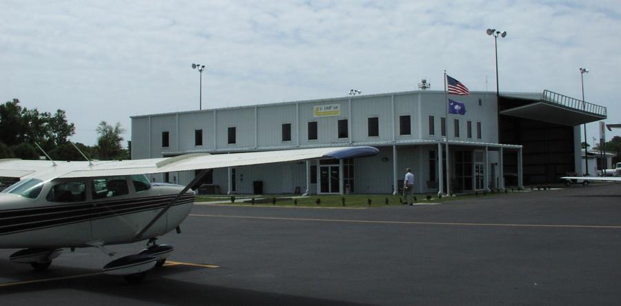
 A quick
jump across runway 20 took me to familiar Rick Aviation, which
managed a quick turnaround, as always. I then decided to call my
sister to let her know my itinerary. An avid weather buff with
several years of experience in predicting Florida weather, she
commented about the prospect for thunderstorms, but I reassured
her that I would not take any unnecessary risks, and had, in
fact, considered stopping on Hilton Head Island for fuel and a
last minute check on the weather in Georgia and northern Florida
before proceeding on the final leg.
A quick
jump across runway 20 took me to familiar Rick Aviation, which
managed a quick turnaround, as always. I then decided to call my
sister to let her know my itinerary. An avid weather buff with
several years of experience in predicting Florida weather, she
commented about the prospect for thunderstorms, but I reassured
her that I would not take any unnecessary risks, and had, in
fact, considered stopping on Hilton Head Island for fuel and a
last minute check on the weather in Georgia and northern Florida
before proceeding on the final leg.
Although Rick Aviation didn't have NEXRAD radar imagery available, a quick call to my friends at Flight Service revealed that the weather was good through Grand Strand. When asked about forecasts for the Hilton Head, Savannah, and Jacksonville areas, the briefer noted that thunderstorms were a real possibility later on in the day and suggested I get another briefing at Grand Strand. A given.
On to Grand Strand
 Not
long after departure from Newport News, I was switched to
Washington Center. The controller, who was obviously enjoying his
time helping everything from Boeings to Cessnas fly through his
sector, called me and said "Do you want to fly the route, or use
that fancy GPS gizmo to go direct to Grand Strand?" In an equally
jovial tone I replied "We paid ten grand for the thing...you bet
I'll take direct! Thank you sir!".
Not
long after departure from Newport News, I was switched to
Washington Center. The controller, who was obviously enjoying his
time helping everything from Boeings to Cessnas fly through his
sector, called me and said "Do you want to fly the route, or use
that fancy GPS gizmo to go direct to Grand Strand?" In an equally
jovial tone I replied "We paid ten grand for the thing...you bet
I'll take direct! Thank you sir!".
Immediately following this exchange he told an airliner "American XXX, go direct YYY", and the pilot came back with "Uh, unable sir. We're slant alpha today". The controller then said, "oh, I guess it would help if I read your type...but you can't blame me...we have kids working in this building that don't know a time before slant golf!"
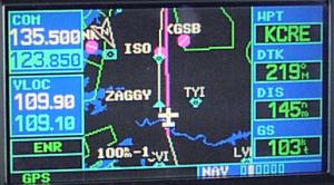
After I stopped chuckling, I flipped to the Garmin's active Flight Plan page, selected KCRE, pressed the DIRECT key, and was greeted with what I believe is the longest direct-to distance I've ever been cleared under IFR -- 157NM. Wahoo! Talk about easy navigation and ETA calculations. :-) Naturally, of course, since the direct route was pretty close to the airways route, I kept plugging in VORs to serve as a backup, and to keep up to speed with my morse code training.