


To The Vineyard!
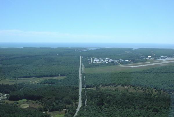
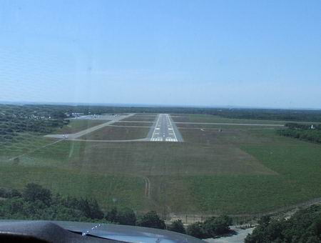
On approach to runway 24, Vineyard Haven, MA
In early August I determined that the aircraft I fly on a regular basis needed some TLC from our local avionics shop. A few weeks and a few Ben Franklin's later, the aircraft found its way back to the hangar with VOR and localizer receivers tuned to specification, glideslope receiver #2 and transponder repaired, and static / altimeter system and transponder inspections completed for another two years. Such is life with private aircraft ownership.
Since we missed out on flying for three of the nicest weekends of the waning summer, we felt completely justified scheduling a flight to one of the nicest vacation spots on the east coast before the warm, sunny weather retreated to a latitude far south of our own. We were bound for Martha's Vineyard.
Using my recent experience obtained flying to Groton, CT from our base in Old Bridge, NJ, I manged to file an IFR route very close to the one we received from McGuire TRACON one pleasant September Saturday morning...
Cessna 9803C, cleared to the Martha's Vineyard airport via direct RBV V276 DIXIE V16 JFK V229 BDR V475 V188 TMU V374 MVY Direct, maintain 2000, expect 7000 10 minutes after departure, departure frequency 120.25, squawk 4040".
We soon contacted McGuire Approach and heard those beautiful words all instrument pilots love to hear, "radar contact". Of course, every time I receive a clearance into the IFR system it reminds me that we have the finest air traffic control system in the world, manned by a dedicated staff of professionals whose only goal is the efficient and safe movement of ALL air traffic, no matter whether we have one, two, or 10 engines, burn 100LL or JET-A, or fly at 100 or 500 Knots. I'm comforted by the fact that a portion of our fuel cost ($2.25-$2.75 gallon) goes directly to supporting this system, rather than having to write a check every time we use the system. And, to think...some people in this country wish to destroy what works so well. But, I digress.
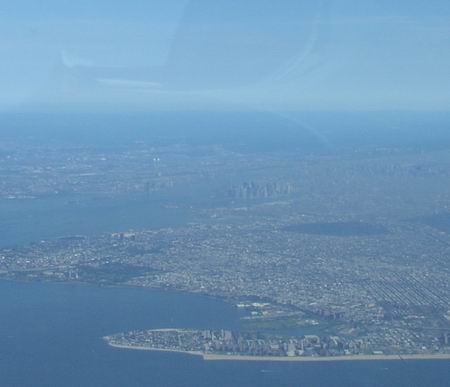
Although I had been flying quite often in recent months,
visibility and ATC routing prevented me from seeing what I saw
this day from the air for the first time. As I gazed down on the
city I had practically grown up seeing from the air, all I could
think about was how much I relied upon the towers as a point of
reference. When I was learning to fly back in 1987, I remember
thinking that if I ever got lost or disoriented in the local
practice area I could always look to the towers to help me find
my way home. In spite of being far 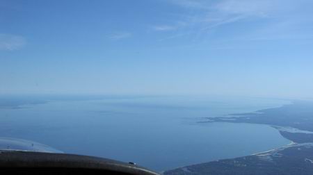 more
familiar with the area and with the needles perfectly centered
this calm and clear September morning, I looked around the city
for that familar landmark and felt strangely lost.
more
familiar with the area and with the needles perfectly centered
this calm and clear September morning, I looked around the city
for that familar landmark and felt strangely lost.
Even at a leisurely 100 knot groundspeed, we soon passed over the southern portion of Long Island and started the first of a few overwater legs we could expect along our route. At this point my friend and co-pilot jokingly remarked "sure wish the visibility was lower", referring, of course, to the last time we took this route when the visibility was so low that we had a difficult time distinguishing land and water. Somehow having floatation gear aboard didn't make us feel any more comfortable about crossing a body of water on a route that would take us outside of gliding distance from shore. All I could think about is how much different I felt when flying IFR in the Seminole, over water or not. Something tells me if I buy an airplane, I'm destined to say "damn the cost" and own a twin for this very reason. The picture above is looking northeast across Long Island Sound. Bridgeport is to the left.
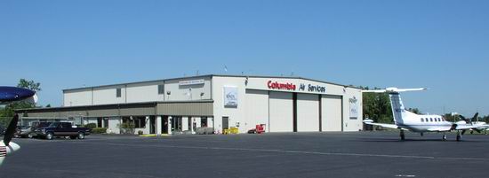
I don't know whether it was that extra juice I had earlier that morning or just looking down at all that water, but somewhere over Bridgeport I reached a conclusion that I'd need to make a pit stop, so I figured we'd stop at the familiar Columbia Air Service in Groton, CT to fill the airplane's tanks and empty my own. The price of fuel was $2.30 (full service), but get this...their self-serve pumps are back online after a year of downtime and if you're willing to pump it yourself, you can save over 30 cents a gallon. I have a thing about supporting the facilities I use, and I was just plain lazy after pumping my own fuel at our base, so I was happy to pay the extra $0.30/gallon.
After a quick but casual turnaround, we were off on our final leg to MVY. Of course, since we changed our destination enroute, we didn't have an IFR flight plan for the leg. Since the weather was obviously so beautiful as to make the effort of filing a new plan for the short 66 NM hop to MVY a waste of time, we decided to exchange our instrument charts for a current Sectional and fly along the coast, travelling slightly north of east until east of Providence, RI, as this would minimize the distance of our over water leg. Since we knew we would not be within gliding distance of shore, I suggested to my friend that if we lost our engine before or even slightly after the midpoint in the leg we would turn back to the mainland coast. Why? 3500 feet below us hugging the mainland coast were dozens of boats and sailing craft enjoying a lazy weekend on the water, and I figured if we had to ditch, we'd do it as close as possible to one of those vessels rather than have to swim several miles to shore (I'm in good shape, but not THAT good).
Within 20 miles we received the Vineyard ATIS:
Vineyard Haven Information Juliet, Time 1552 Zulu, Wind 220 @ 8, V10, Sky Clear, Temperature 26, dewpoint 16, Visual approach, landing and departing 24. Ground control frequency 121.8 is in operation. Altimeter 30.29. Advise on initial contact you have Juliet.
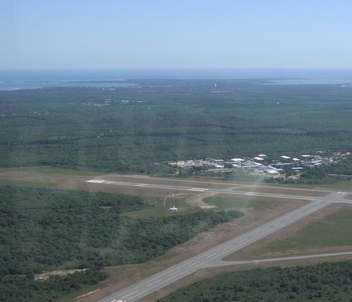
The first call to Tower was the most difficult, since we apparently caught the sleepy island in a LaGuardia-like push. Fortunately we got a word in edgewise and the controller told us to report five miles west for the right downwind 24. This distance happened to coincide with the western shore of the island and nicely set us up for a 45 degree entry to the downwind. The tower called some Navajo traffic paralleling our course inbound, but he proved to be "no-factor". We shortly found ourselves on final for 24.
The only interesting aspect of the landing happened when we turned off. The Horton STOL kit made easy work of making the first taxiway, but we noticed that instead of the hold line being equidistant between the runway and the parallel taxiway, it was within perhaps 20 feet of the parallel. Since I was always taught to pass the hold line after turning off, I was surprised when the tower controller asked us to hold short of the line. We figured the non-standard location was in support of glideslope protection (notice the GS shack on the right side of the runway), but we asked ourselves how many people may have gone past that, only to slightly block the parallel. A little disconcerting to this first-timer, but quite manageable. Would I send one of my students here? Uh, no. I had actually thought about calling the tower after the fact but I was too busy starting to think about food... since I was HUNGRY.
Realizing that we had arrived only about 20 minutes before our scheduled departure time, the ground controller asked how long we planned to stay, in an effort to get our clearance ready.
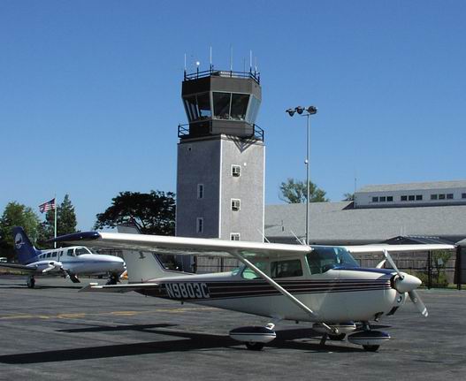
We received the usual line crew welcome from a "blue shirt" as the ground controller put it, and parked next to a 402 in Cape Air dressing...the air taxi service from which Sandpiper Air was modeled on the NBC comedy "Wings". Unfortunately, Crystal Bernard was not to be found.
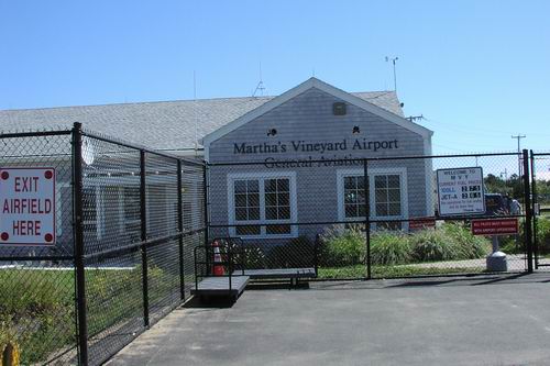
Just to the right of the tower was the General Aviation terminal. The biggest surprise here was the level of security. From large 10 foot tall fences (which sadly clashed with the otherwise classic and clean New England Cape Cod architecture), to punch code locks at each gate, down to the urging of the line crew to "follow them" as we walked into the terminal area to sign in, this was the tightest security I'd seen at any General Aviation airport including nearby Bradley International.
Not surprising, however, since the airplane to our right rear (out of the picture) was a United Airlines ATR. Yes, folks...this sleepy little island has real passenger service and they share the very same ramp with GA. When we arrived and signed in, the ops manager asked how long we would be staying and after volunteering 2 hours told us that parking was free.
A brief walk outside through a breezeway and we managed to find the terminal and the restaurant.
Due to security restrictions, I couldn't take any pictures in the terminal, but it really is beautiful piece of architecture. The roof is a very tall post and beam, but with what appeared to be 2" thick steel rods tying everything together in a truss system, secured with what had to be the biggest cotter pins I'd ever seen. If you're a fan of architecture, it's something to behold.
After a casual lunch at the fine Plane View restaurant, we did our walk around, filled the sump with a quart of 15W50, and hopped in to prepare for the flight home. After we spooled up and called ground, they gave us our clearance...
Cessna 9803C, cleared to the 3N6 airport via Runway Heading, Vectors to intercept V374 GON Direct CCV V16 JFK, Direct COL, Direct, Maintain 2000, Expect 6000 10 minutes after departure, departure frequency 133.75, squawk 3533.
Most of the return trip was as expected, until we reached the Calverton VOR on Long Island.
Out of the noise floor of COM2, which was tuned to Guard, we began to hear the very distinctive tone of an ELT signal. At that point, the signal was faint, and at a signal-to-noise ratio that experience told me was probably around 20-30 miles away.
Of course, without any direction finding equipment on board and no trend information as yet, all we could do was inform the current sector controller that we had started to pick up an ELT signal. The controller acknowledged our report and soon thereafter told us to switch frequencies to the next sector. After checking in, the ELT signal started to become too distracting, so we disabled the COM2 receive audio and began to check it every couple of minutes to determine the change in signal strength.
After several minutes it became clear that our westward track was bringing us closer to the signal, to the point that after covering approximately 20 miles, we found outselves within five miles of the Farmingdale, NY airport with the ELT signal at full quieting. Naturally, we informed the current sector controller that based on this trend and signal strength, we believed the signal to be from an aircraft at the airport. The controller thanked us for the report and sent us on to the next controller.
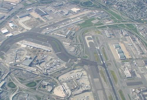
That good deed done for the day, we continued to focus on the last two legs of the trip. We thought we were home free, but we spoke too soon. Upon arriving over JFK, we looked down to find the JFK airport practically deserted. As we turned southwest to start our short overwater hop to the New Jersey coast to Colts Neck VOR at around 4PM, we were asked to descend to 5000 and switch frequencies to another NY approach controller.
As I slid the new frequency into the active COM position we were greeted with a controller firing an seemingly unending round of vectors to aircraft inbound to JFK. I tried to check in, but couldn't get a word in edgewise. As the Jersey coast came into view, we saw the reason why...a string of inbounds as long as we could see, on vectors to the JFK final approach course. No surprise there weren't any aircraft on the ground at JFK -- they were all in the air waiting to land.....NOW. When I finally did get a word in, I asked for lower, expecting full well that the controller wouldn't be able to clear us until we were well on the west side of the push...and very close to (if not on top of) the navaid serving the feeder route for our home field's VOR approach.
So, what do you do when you find yourself within about 3 miles from your effective clearance limit 3000 feet above the recommended altitude for the approach procedure, without an approach clearance, and are not talking to the approach facility that serves the airport? You hold...and that's exactly what we were planning to do, when within those three miles, the NY controller cleared us down to 3000 feet (still 1000 feet high), and asked us to change to McGuire approach, the facility serving the VOR approach into our home base.
I managed to grab a break in the near nonstop communications on McGuire's frequency shortly after the ambiguity indicator flipped to FROM, so I told them, in one quick breath, that we were decending from 4300 to 3000 and entering a hold at Colts Neck VOR. The controller replied that we were cleared direct to the airport. I then mumbled something under my breath that my friend heard loud and clear.
So, here we are, a Cessna 172 SLANT ALPHA, established in a right turn to begin our hold and the controller throws a curve ball like this. There were two things wrong with this request. First, the controller assumed I wanted a visual approach (I did, but that's not the point...we didn't even discuss my intentions beyond the hold), and second, she again assumed that I had the ability to *legally* navigate directly to the airport, and, lacking an IFR-certified GPS (actually, any GPS), I clearly did not. I then corrected the controller, and informed her that we were not GPS equipped and required vectors for the visual approach.
Thankfully, due to good visibility and clear skies, we picked up the field quickly, cancelled IFR and made a wide circling approach to a safe landing.
After tugging the airplane back into the hangar and completing the post-flight paperwork ritual, we determined the total time for the trip was 4.3 hours, average groundspeed was 100 knots, and (thankfully) we didn't need to write up any new squawks on the airplane. That should be worth a few Ben Franklin's, right?