


Ferry Flight, The Sequel
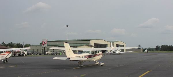
In mid June 2002, a few days after spending an entire week thrashing about in a Piper Seminole to get my MEI, I arranged with a friend to bring his Cessna 172 home to NJ from his vacation home in Florida, the reverse of my trip in November. I had helped the owner sell his Cessna 150 this month as well, so this time we would have to get to Florida on the airlines.
No thanks for flying the unfriendly skies
In spite of using all of this new-fangled online technology to find a decent airfare, we wound up going to a travel agency because my friend and I couldn't find a nonstop fare from Newark to Orlando online for less than $400. Although our first preference was to fly from Newark (EWR), we were ultimately forced to book a flight out of LaGuardia (LGA), the delay capital of the world, on Spirit Airlines.
This was my first take to the commercial skies since 9/11, and I expected some additional security, but I could never have believed what I'd be subject to unless someone actually told me to expect it.
It started unobtrusively enough as my friend and I were asked for a picture ID when we checked in. Then things got ugly. Our number apparently came up and we were chosen at random to have our luggage and person searched. The ticket agent put two red stripes on our boarding passes and luggage tags, and then led us to a small room adjacent to the ticket counter where we were forced to watch as some $5/hour guy opened our luggage to poke and prod our personal belongings.
Figuring the worst was over, we spent some time in the common area / food court before proceeding down to the gates. There, we met the usual carry-on luggage scanners and metal detectors. A few snarling faces from the security personnel later, we were through to the gates. We were left alone in the gate area until we got to board the aircraft. Given that we had been pretty thoroughly searched (well, no body cavity search, but you get the idea) we thought we'd merely hand our boarding pass to the gate agent and waltz on board. Oh no... We were again pulled aside while one person searched our carry-on bags (again) and another patted us down and used the wand in an effort to prove us guilty...of something. At that very moment my patience began to wane. I honestly began to feel like a criminal and convinced myself that I wouldn't be surprised if they asked to fingerprint us.
Overall, it was a very irritating, personally invasive experience that I do not wish to repeat. It made me realize that if there is ever a need for General Aviation and personal aircraft, it's now. You can bet that I'll fly personally from this point on if the mission profile fits the aircraft available to me.
 Finally, Friendly faces at FL310.
The good news was that once on board, Spirit Airlines provided a good flight and a friendly atmosphere for a reasonable price ($125 one-way).
The only downside of the MD-80 we flew was the lack of legroom (my knees hit the seat in front of me, and it got worse when the person in front of me reclined). I'd recommend flying Spirit if you can avoid the MD-80.
Of course, the one remaining perk to commercial flying is that some airlines still hold to the tradition of hiring beautiful young women as flight attendents. I fell in love with one of our flight attendents and had a nice chat during which I told her I was a pilot and asked her about the airline. For those of you that care, she happened to mention that they are hiring F/Os...minimum pilot time just to apply...2500 hours.
Our flight arrived only 10 minutes late, which was pretty good performance since we sat on the ground at LGA for 20 minutes waiting for takeoff. We arrived shortly after 2PM, a time we scheduled because we wanted time to get to the Titusville (TIX) airport and prep the aircraft for the early morning departure awaiting us.
Seat-of-the-pants IFR
The Garmin GPS-100AVD unit that was in the Cessna 172 for the trip down last fall was sold with the owner's Cessna 150, so we had prepared to fly the 800 mile trip up the coast with little more than the traditional equipment...two VORs and a DME. Autopilot? Nope. Sferics device or Radar? Nope. This was going to be a good dose of seat-of-the-pants IFR...during prime thunderstorm season. Granted, my copilot brought along his Garmin GPS95XL as a backup, but due to poor battery life, we really couldn't use it continuously.
Fortunately, I had taken a couple of instrument practice flights before going for my MEI, and continue to shun the use of GPS during instrument currency flights for the very simple reason that these boxes make IFR flight too easy, and it's always better to practice with less. As an extreme example of this, one of my friends covers the AI and DG on all instrument practice flights. As a result, he's become very good at keeping the greasy side down and timing turns. I don't carry it that far, but do my share of minimalist IFR for occasions just like this. Give me a basic flight computer a single flip-flop VOR and I'm safe, if not entirely happy.
Pre-preflight
Upon arriving at the airport took the airplane out of the hangar and performed a thorough preflight and runup to ensure the aircraft was airworthy. The battery was clearly discharged with the voltmeter showing 11.2 Volts, but with a little prime and coaxing of the throttle, I managed to start the aircraft and verify the systems worked to my satisfaction. We also grabbed a bottle of air from the FBO and brought the nose and one main tire up to spec.
Later that evening, after a good hearty dinner at the Durango Steak house (co-located with our hotel), I called flight service and planned the four proposed legs from Titusville (TIX) to Jacksonville Craig (KCRG), to Myrtle Beach / Grand Strand (KCRE), to Newport News (KPHF) and back home (3N6). I had some concern about thunderstorms and heavy rain that had blanketed most of Florida for the past couple of days, but all the forecasts seemed to indicate that the trough spawning the instability was dissipating and pushing most of the weather offshore. Weather was anticipated to be relatively good MVFR to VFR conditions in the morning with any thunderstorms off the shore.
We awoke at 5:30 on the morning of June 20th to 1200 overcast and 4 miles in light rain showers, and, unfortunately, an increased area of weather hovering betwen Daytona Beach and our first stop, Jacksonville. There was also a noticeable increase in the on shore flow up through Georgia and particularly South Carolina. The last evening the winds aloft were forecast at around 180 @ 7. This morning they averaged 150 @ 12.
After watching the weather channel and checking the latest radar at the airport before leaving, it became clear that if were planning to depart, we'd better do it soon, or risk having Jacksonville shut down in level 3-4 thunderstorms drifting very slowly inland at about 5-10K. I was still concerned about not being able to reach Grand Strand as planned, but I learned a long time ago to take one leg a time. Weather can change from minute to minute.
I started the aircraft and moved it to the FBO in order to get fuel and ran the engine at 1200 RPM or better during the taxi to help charge the battery, and didn't think much of the run over there.
Once the fuel was sumped and the level checked, we got all of our stuff together in the airplane, parked the owner's car in the hangar, locked everything up, and hopped into the aircraft, ready to begin our trek. I decided to keep the beacon off during the start to reduce the load on the battery, looked around the aircraft for a bit, called "clear prop" and turned the key, expecting the aircraft to start right up. No such luck. It turned over a few blades and then stopped dead in its tracks. I tried it once more and realized that the battery was near toast. Guess that was one start too many.
After muttering a few obscenities and envisioning ourselves getting pummeled riding the CRG ILS 32 approach course down into a stormy Jacksonville, we got out of the aircraft and contemplated our next move. I decided that before I went to get a battery cart that I would wait a few more minutes and try it once more, this time with a bit of prime and pumping of the throttle (something I don't like doing for fear of encouraging an engine fire). I hoped that 5 minutes was enough time for the battery to "self-recharge" to the extent necessary to turn a couple of blades.
Amazingly, the engine turned slowly at first and almost stopped again, but then a cylinder fired. Then another, and another. Running rough and stumbling at first, it finally caught and before I knew it, was idling at 1000 RPM, the ammeter showing about a 20 amp charge. I motioned to my friend to come around to the other side of the aircraft and hop in. Within a few minutes, we had the stack lit up, had received our clearance, and began our taxi.
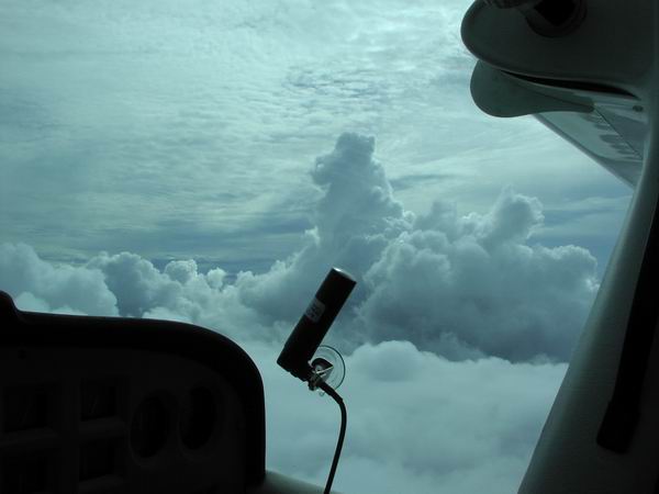
TRW avoidance on the fly
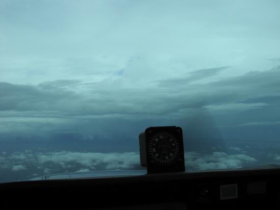
After we switched to Orlando departure on our climb out of Titusville, it became clear that some weather was beginning to form along the coast about 25 miles north of our departure airport and that our first leg was smack in the middle of it. I called departure and asked for a vector to intercept a route that would parallel our original course to the west. As we bounced in an out of the clouds up to our cruise altitude of 5000 feet, we could see intermittent ground contact and a darkening sky to the east/northeast.
After nearly an hour of IMC, we managed to circumnavigate the storms and land at Jacksonville Craig for fuel, and some planning.
A quick login to duat.com revealed that not only had the weather NOT retreated south of us...it had become far more intense. Greens, yellows, and lots of red. We got out of TIX in the nick of time.
Of course, the problems weren't entirely behind us. A quick look ahead on our next leg along the coast of Georgia, NC, and SC showed significant thunderstorm activity and heavy rain that was being fed a continuous stream of moisture off the Atlantic from moderate southeast winds. A radar loop told the story...the storms were nearly stationary, and where the precipation did appear to move as a cohesive unit inland, new echos formed behind them, indicating ripe conditions for further storm development. Going to Grand Strand was out of the question. On to plan B.
One of the nicer aspects to FBOs I've seen as of late is a PC with raw internet access (as opposed to those fixed commercial services), and Craig Air provided one for us to use in its flight planning center. I logged in to duat.com with my userid, and immediately had access to my aircraft profile I had entered long ago. This in combination with duat.com's flight planner allowed me to quickly develop an alternative routing that took us almost due north to Columbia, South Carolina (KCAE), around the storms hugging the coast. The weather seemed to improve somewhat in North Carolina (it did not extend as far into the state), so I decided to take us to Kingston (ISO) via Florence and Fayetteville, and then on to our original planned stop of Newport News (PHF). I used duat to file the new flight plans to PHF, but thinking that we'd arrive nearly on schedule there (within an hour or two) I decided to leave the final leg plan in the system.
I again fell in love with the beautiful Craig Air girls, but was soon forced to leave my heart behind with a particularly attractive brunette wearing a blue blouse and short black skirt that will be etched in my mind forever, as we departed for our 2+20 hop to Columbia SC. Since the weather off the coast was still hanging tough between Jacknsonville and the Brunswick (SSI) vortac and up towards Savannah, we took a more westerly track via V267 to BAXLY intersection, V157 Allendale V37 Columbia, direct. We launched into the soup and even at 7000 feet were pretty solid IFR, with only occasional faint ground contact.
While enroute, HIWAS informed us of a string of convective sigmets and Center Weather Advisories posted for thunderstorms along the coast from central Florida to North Carolina. The weather in Northern Florida had closed down behind us...as I had predicted, but the forecasts had not.

Just south of Columbia, the weather started to clear, but we had noticed our groundspeed diminish quite rapidly, to the point that we were doing at best 100K over the ground, while truing out at 115. Once we got out of a bulk of the weather and north of the trough, the winds shifted to the Northeast. These too, were stronger than forecast, which was consistent with the changes in weather we were seeing.
South of the Allendale VOR (about 40 miles south of Columbia) our transponder went on the fritz. A couple of controllers prior to this had noted an occasional drop, but weren't too concerned about it. However, Columbia's primary radar was out of service that day, so we effectively became non-radar for about 10 miles. The Columbia approach controller requested we report over Allendale. Shortly after we did, he picked up the transponder again and all was well. (Who says you don't need to know about a non-radar environment in the continental US??)
This was the first time I'd ever been to CAE. I picked Eagle Aviation totally at random as we were taxiing in, and wound up taking a chance on a nice tuna salad sandwich out of the vending machine. For $2, plus $1 for a resealable 1 liter bottle of Pepsi, I figured I'd done pretty well. Unfortunately, I had to take the bad with the good. Fuel cost was $2.90...the highest I have ever paid in my 15 years of piloting. When I considered that I just successfully circumnavigated some pretty nasty weather, I considered myself lucky to be here and shrugged off the bill.
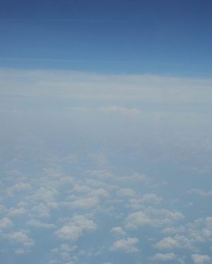
After an hour break, we departed CAE for Kingston Regional JetPort in North Carolina. Since our trip would take us east northeast, we noted the cloud density increase again as we got closer to the coast. Although crusing at 7000, we weren't able to top all of the buildups. We got some more actual and even got to play "avoid the cumulus granite" as we took the liberty of banking steeply in an attempt to dodge hitting the "mountains". Hey...what do you expect on a long, otherwise boring flight? :-)
As we made our way up V56, we made a call to Raleigh Radio to get the weather for the next few airports along our route to confirm that the weather had not moved farther inland than expected. After giving a pirep, the briefer offered updates to the same convective sigmets we heard south of Columbia and noted that the weather was east of our planned route by only about 30 miles. We noted the telltale anvil tops of the L3-L5 storms and remarked to the briefer that it was definitely darker to the east.
The second half of that leg took us more to the northeast and away from some towering cumulus we'd been eyeing at 12 o'clock for the past 50 miles. After riding the ILS 5 to aid in orientation and practice, we landed at familiar ISO to pick up fuel, this time at a more sedate $2.15/gallon.
At this point, I realized that we were running a bit late, so I thought I would change the departure time of the final leg with a call to Raleigh flight service. They said the plan had already shipped to Washington Center, but since he couldn't get a hold of them on the landline, the briefer kindly offered to refile the plan. That done, following a brief check of the weather courtesy of the weather channel and the FBO's nice wide screen TV, we departed for our quick hop to our second to last stop of the day...Newport News.
That leg was mostly routine. We called in a pirep, got the weather for PHF and the last leg of our flight home, and generally confirmed that the worst weather was behind us. Up at 7000 and above the scattered deck, we flew in smooth air at 115 KTAS, and a slightly improved groundspeed of 105 knots. This was consistent with the winds aloft forecasts, which had been updated to reflect the stronger winds to our south and lighter winds to the north. We decided to shoot the ILS 7 at PHF, and were told to keep our speed up because of an inbound 717. I brought the power up to 24/2400 and pushed the nose over at GS intercept to get 120 KIAS. My friend flew the approach from the right seat as I made radio calls and gave speed and altitude callouts. At minimums I took over the approach and landed, and turned off as the 717 was nearing a 1/2 mile final. My friend noted how nicely the spacing worked out, so I called ground and asked her to give approach our regards for a job well done.
Upon stopping at Rick Aviation, we asked for a quick topoff while I called ahead to the owner to arrange for ground transporation for my friend back to his place. We had originally planned to fly him up to Teterboro, but given that the sun had set and we now expected to arrive at Old Bridge at 10:40 this evening, the owner offered to pick him up at Old Bridge so we could put the aircraft to bed and I could go home and get some much needed sleep.
Perhaps it was chance, or maybe it helps to compliment controllers for the small things...I don't know exactly...but the Norfolk Departure controller seemed very friendly to us on our climbout. He took some extra time to work out a new routing that would skirt some restricted areas and shorten the southern portion of our route by a few miles. He then said in a jovial tone that he'd use his "whiz bang RNAV computer" to get us a vector direct to Salisbury, MD, about 75 miles away. Interestingly, we were able to pick up the UHF portion (DME) at that point, but we didn't get the VHF (VOR) portion until we were about 55 miles from the station. Usually it's the other way around. Once we were receiving SBY, we were cleared direct.
We then switched over to Dover approach and he gave us a new squawk code. Since the frequency was quiet and it was getting late (about 9PM), I asked him what usually triggers a new squawk code. He said that it can happen for a variety of reasons, but the reason it happened this time is that the route had changed and the computer wouldn't take it for some reason, which forced him to renter the plan. Since the computer considered it a new plan, it spit out a new code. Ya learn something new every day.
The remainder of the route took us up V29 to Cedar Lake, over V16 to DIXIE, then direct...which brings up an interesting point...
I've been flying IFR for a long time...and was one of the first to fly with a field-approval on a VFR GPS installation in the Northeast Region FAA office back in 1990. This was at a time when VOR-DME RNAV was the only IFR-approach approved area navigation available, very few pilots utilized the boxes even if they were installed, and the GPS constellation was not yet complete. GPS signal coverage outages were commonplace, and sometimes I'd receive only 3 satellites -- barely adequate for 2D navigation. During this time, ATC would never clear an aircraft direct to an airport; they would always specify the visual approach or require me to shoot an instrument approach.
Now, controllers seem to assume you have a GPS on board, or the capability to navigate directly to the airport. In spite of the fact I continue to file /A in aircraft suitably equipped, controllers continue to clear me direct to the airport from fixes that are not part of any approach for that airport, and every time I had to let them know we didn't have that capability...even if we had a VFR GPS on board (since that's obviously not legal for reference under IFR). Guess it goes to show how much GPS is changing the world of IFR
Statistics
We landed at Old Bridge uneventfully at 10:40 PM. I got home at 11:30 and was in bed by midnight, which concluded our 19 hour day and our two-day adventure. We managed to put 11.2 hours in the Total column, log 3.0 hours of IMC, and 2.5 Night. We also managed to shoot three instrument approaches, and write up 10 squawks on the airplane.